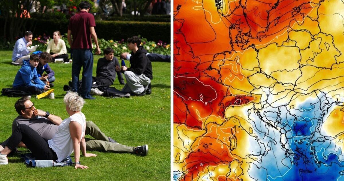
Weather maps have turned purple and white, indicating that the UK is set to experience unsettled and cold conditions in just over a week's time. The forecast by WXCharts using MetDesk data reveals that the majority of the nation will see either snow, rain or both sweep in from the east.
The chilling conditions will arrive from as early as midnight on Tuesday, May 6, with Scotland taking the bulk of snow, but it stretching down to the north of England. Showers are expected to cover much of the south of England.
However parts of the Midlands including Birmingham and cities in north England, such as Manchester and Newcastle, will also see wet conditions. The maps follow shortly after reports of a mini heatwave that is expected to hit the country early next week.
Along with the snow and showers, temperatures are due to fall past zero in various regions. Inverness will see them fall right down to a frosty -3C, by midday, temperatures will improve reaching 0C. In contrast, cities in the south including London, will feel temperatures of 6C at midnight, before taking a sharp fall in the afternoon to 2C.
The Met Office has informed Brits of the unsettled conditions that the UK will face as the new month arrives. According to the weather agency's Long Range Forecast for the period of Thursday, May 1 to Saturday, May 10. The new month will start of with dry conditions, that will take a turn towards the end of the stated period.
It reports: "Following a widely fine and very warm spell through the week, temperatures are most likely to return back closer to average from the north during Thursday and Friday.
"Whilst a little rain is possible during this transition, most areas remaining largely dry. Largley fine but cooler conditions are then most likely over the weekend.
"However, likely cloudier and breezier at times across some northern areas with a chance of rain. Into the following week, conditions will probably turn more changeable overall, with dry, settled periods interspersed with some spells of wetter weather."
The report adds: This will bring some showers or longer spells of rain at times, which could be heavy and thundery in places. Temperatures will likely be around average."
Today:
Often cloudy withy patchy rain and drizzle at times, mainly in the west. Elsewhere some sunnier breaks developing allowing for the ood shower to break out. A much drier and brighter day across Northern Ireland. Feeling warm in the sunshine.
Tonight:
Any patchy rain and drizzle soon easing to leave clear spells across England and Wales with some fog patches. Turning breezier in the northwest with outbreaks of rain.
Sunday:
Heavy and persistent rain continuing across the northwestern parts. Elsewhere, any mist and fog lifting to leave a dry day with plenty of sunny spells. Feeling warm in the sunshine.
Outlook for Monday to Wednesday:
Cloudy with outbreaks of rain in the northwest on Monday, otherwise dry with sunny spells as high pressure builds. Temperatures climbing, feeling very warm by day across England and Wales.